FLAC3D

Claim Profile

Explore product information, features, pricing, and buyer feedback.

No approved reviews yet. Be the first to review
Visit Website Write a Review
Decision Snapshot

FLAC3D Evaluation Snapshot

Review the most important product facts, official access information, and SoftwareWorld’s page-level trust standards in one place.

User RatingNot rated yet
Starting PriceContact Vendor
Free TrialNot specified
Free VersionNo
APINot specified
DeploymentCloud Hosted
HeadquartersUnited States
Buyer Contribution

Your FLAC3D experience can help other buyers

Used FLAC3D? Share an honest review about usability, features, support, and overall experience. Your feedback can help other buyers evaluate the product with greater confidence.

Reviews are published after SoftwareWorld moderation.

Write a Review
Trust & Transparency

Why Buyers Can Trust This Page

Structured Product Information

Consistent buyer-focused fields make software profiles easier to evaluate.

Clear Sponsored Disclosure

Paid placements are labeled and separated from product facts and reviews.

Editorial Independence

Sponsored participation does not influence SoftwareWorld's editorial assessment.

Data Transparency

Pricing and availability can change, so current details should be confirmed with the vendor.

Product Overview

FLAC3D Overview

Product description, media, company details, support, training, deployment, customer size, languages, and industries.

About FLAC3D

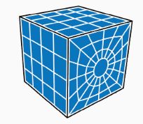
FLAC3D is a GIS (Geographic Information System) software that enables geologists, engineers, and environmental scientists to model and analyze geological data in three dimensions. The platform provides tools for simulating rock behavior, visualizing terrain, and assessing structural stability, making it ideal for mining, construction, and environmental projects. FLAC3D includes data visualization and analysis features, allowing users to interpret complex geological data and make informed decisions. The software also supports customization, enabling users to tailor simulations to specific project needs. By offering detailed 3D modeling, FLAC3D enhances project planning, improves safety assessments, and supports sustainable resource management.
Company Itasca Consulting Group
Founded NA
Headquarters United States
Employees NA

Support

NA

Training

NA

Licensing & Deployment

Proprietary Cloud Hosted Web-Based

Typical Customers

Self-Employed Small-Business Midsize-Business
Languages Supported 1 language available
English
Industries Served 5 industries available
Architecture & Planning Computer Hardware Consumer Goods Information Technology & Services Telecommunications
Category-Based Capabilities

FLAC3D Features

Each category combines the selected software category, its category-specific description, and the features assigned to that category.

Geographic Information System (GIS) Software 21 selected features Open category ↗
Interoperability Labeling Census Data Integration Route Optimization Spatial Analysis Map Sharing Geographic Maps Location Tracking Geotargeting Monitoring Geolocation Geocoding 3D Imaging Data Mapping Internet Mapping Image Management Map Creation Color Codes/Icons Data Visualization Statistical Analysis Trend Analysis
Pricing Information

FLAC3D Pricing

Pricing type, currency, trial availability, payment frequency, destination links, and package-level starting prices.

Pricing Type Contact Vendor
Preferred Currency USD ($)
Free Trial NA
Free Version NA
Payment Frequency NA
Alternative Products

Top FLAC3D Alternatives

Explore leading products commonly evaluated alongside FLAC3D.

View All FLAC3D Alternatives ↗
Frequently Asked Questions

FLAC3D FAQs

Answers generated from approved profile information, selected options, packages, integrations, support, training, deployment, and devices.

FLAC3D is a GIS (Geographic Information System) software that enables geologists, engineers, and environmental scientists to model and analyze geological data in three dimensions. The platform provides tools for simulating rock behavior, visualizing terrain, and assessing structural stability, making it ideal for mining, construction, and environmental projects. FLAC3D includes data visualization and analysis features, allowing users to interpret complex geological data and make informed decisions. The software also supports customization, enabling users to tailor simulations to specific project needs. By offering detailed 3D modeling, FLAC3D enhances project planning, improves safety assessments, and supports sustainable resource management.

  • No, FLAC3D does not offer a free version.

  • Yes, FLAC3D offers a free trial.

  • No, Credit Card details are not required for the FLAC3D trial.

  • No, FLAC3D does not offer an API.

  • FLAC3D supports the following languages:
    • English

  • Following are the typical users of the FLAC3D:
    • Self-Employed , Small-Business , Midsize-Business

  • FLAC3D supports the following deployment:
    • Cloud Hosted

  • FLAC3D supports the following devices and operating systems:
    • Web-Based
Are you an authorized FLAC3D representative?

Claim this profile with an official business email to request management access. Public product information and approved reviews remain available before the profile is claimed.

Write a Review Visit Website ↗
Get Expert Help